Three Inches on the Map: The Quiet Joy of County Top Bagging
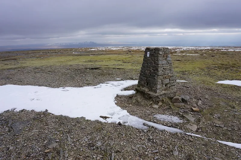
Photo: Bill Boaden , CC BY-SA 2.0, via Wikimedia Commons
A list for the curious, not the competitive
There's a particular sort of hillwalker who's done the Wainwrights, half the Munros and can't walk past a trig point without touching it. And there's a growing number who've discovered something stranger and more interesting: the county top.
Every county in Britain — historic and modern — has a highest point. Some are famous mountains. Many are anonymous bumps in farmland, a trig point behind a hedge, a rise so gentle you'd walk over it without noticing if the map didn't insist otherwise. Together they make up a list that nobody posts on Instagram, that requires an unusual amount of map-reading and negotiation with farmers, and that will take you to corners of the country you have absolutely no other reason to visit.
Which is exactly why it's worth doing.
First, the awkward bit: which counties?
The answer depends on your source. The historic counties — the ones that existed before the local government reorganisations of 1974 and the various reshuffles since — give you around ninety tops, from Ben Nevis down to a field in Rutland. The modern ceremonial counties give you a shorter list of forty-odd, and a lot of people bag both, because they're that sort of person.
The classic tick is the historic list. It's messier, it involves long arguments about boundaries, and it will send you to places with names like Boring Field and Great Chishill. That's part of the charm.
The giants hiding in plain sight
Some county tops are the biggest things in Britain, which is a nice gift on a list that otherwise specialises in obscurity.
- Ben Nevis (1345m) tops Inverness-shire, and the highest point of the whole country.
- Snowdon (1085m) covers Caernarfonshire.
- Scafell Pike (978m) is the high point of Cumberland.
- Helvellyn (950m) belongs to Westmorland.
- Aran Fawddwy (905m) tops Merioneth and sees a fraction of the traffic of its more fashionable neighbours.
- The Merrick (843m) does the honours for Kirkcudbrightshire.
It's a strange quirk of the list that you can tick off some of the country's hardest days out and still be barely into double figures.
The ones that make you work for nothing
Then there's the other end, and honestly, the other end is the point.
Bardon Hill in Leicestershire is 278m of quarry-adjacent hummock that takes twenty minutes from a lay-by. Great Chishill in Cambridgeshire is 146m of arable field with a trig point and a view over precisely nothing. Normanby Top in Lincolnshire is 168m of chalk wold that feels, on a good day, like the edge of the world. Black Down in Sussex, Walbury Hill in Berkshire, Leith Hill in Surrey, Cleeve Hill in Gloucestershire — all modest, all quietly lovely, none of them going viral any time soon.
And then there's Mickle Fell, 788m, the highest point of historic Yorkshire, sitting inside the Warcop military range. It's accessible only on permitted days, which makes ticking it a logistical exercise as much as a walk. Nobody's filming that for a vlog.
That's the trade you make with this list. You give up the summit selfie economy and you get, in return, days out with a purpose nobody else understands.
Access is the real puzzle
Here's the honest warning: county top bagging is not always a right-to-roam picnic.
A fair number of tops sit on private farmland, in hedgerows, behind gates, or on Ministry of Defence land with shooting on it. Some have no legal access at all and rely on the goodwill of a landowner, which means asking, politely, in advance. Others are on access land but without a path to them, so your navigation needs to be sharper than it would be on a waymarked trail.
Practical approach: check the access layer on your mapping app before you commit, then check whether the top is marked as access land, open country, or a very optimistic footnote. If it's farmland, ring the estate and ask. Most people say yes. The ones who say no have good reasons.
Planning a county top day
A few things that make this list far less faff than it first appears:
- Cluster them. Tops in the lowland counties are often close together, so a two-hour drive can net you three county ticks in an afternoon of field paths and lanes.
- Use the train. Some of the best of these are reachable on foot from a station — which is a lovely way to spend a Saturday and avoids the parking row entirely.
- Match the top to the season. Save the giants for settled summer weather and use the lowland tops for wet, cold, short-daylight weekends when a mountain would be a poor decision.
- Take the trig point seriously. Many are listed, mapped and photogenic in a bleak sort of way. It's the only trophy you get.
- Record where you're allowed. Keep notes on access permissions — you'll want them when you're planning round two of the county you abandoned in a huff.
Why the list rewards curiosity
Altitude is a poor measure of a good day out. County top bagging relies instead on a sort of geographical curiosity — the pleasure of standing on the highest point of somewhere, however modest, and understanding a piece of the map better than you did that morning.
You'll end up in villages with strange names, walking lanes that lead nowhere, explaining to a farmer why a stranger with a rucksack wants to touch his hedge. You'll bag some of Britain's finest summits along the way, and a great many that will never get a plaque.
And at the end of it, when someone asks what you're up to this weekend, you get to say, with total sincerity, that you're climbing the highest point in Rutland.